


Voting District OCEAN, Santa Cruz County, California
About
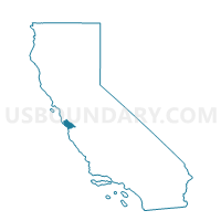
Outline

Summary
| Unique Area Identifier | 543995 |
| Name | Voting District OCEAN |
| County | Santa Cruz County |
| State | California |
| Area (square miles) | 160.71 |
| Land Area (square miles) | 0.00 |
| Water Area (square miles) | 160.71 |
| % of Land Area | 0.00 |
| % of Water Area | 100.00 |
| Latitude of the Internal Point | 37.10748360 |
| Longtitude of the Internal Point | -122.29280840 |
Maps


Graphs
Select a template below for downloading or customizing gragh for Voting District OCEAN, Santa Cruz County, California


Neighbors
Neighoring Voting District (by Name) Neighboring Voting District on the Map
- Voting District 10295, Santa Cruz County, CA
- Voting District 10305, Santa Cruz County, CA
- Voting District 10325, Santa Cruz County, CA
- Voting District 20330, Monterey County, CA
- Voting District 20470, Santa Cruz County, CA
- Voting District 20475, Santa Cruz County, CA
- Voting District 20515, Santa Cruz County, CA
- Voting District 20570, Santa Cruz County, CA
- Voting District 20575, Santa Cruz County, CA
- Voting District 20595, Santa Cruz County, CA
- Voting District 20610, Santa Cruz County, CA
- Voting District 20615, Santa Cruz County, CA
- Voting District 30445, San Mateo County, CA
- Voting District 30755, Santa Cruz County, CA
- Voting District 30795, Santa Cruz County, CA
- Voting District 30810, Santa Cruz County, CA
- Voting District 30820, Santa Cruz County, CA
- Voting District 30830, Santa Cruz County, CA
- Voting District OCEAN, San Mateo County, CA
- Voting District OCEAN, Monterey County, CA
Top 10 Neighboring County Subdivision (by Population) Neighboring County Subdivision on the Map
- Santa Cruz CCD, Santa Cruz County, CA (154,331)
- Watsonville CCD, Santa Cruz County, CA (77,150)
- Half Moon Bay CCD, San Mateo County, CA (28,894)
- Pajaro CCD, Monterey County, CA (17,415)
- West Santa Cruz CCD, Santa Cruz County, CA (4,283)
Top 10 Neighboring Place (by Population) Neighboring Place on the Map
- Santa Cruz city, CA (59,946)
- Capitola city, CA (9,918)
- Rio del Mar CDP, CA (9,216)
- Pleasure Point CDP, CA (5,846)
- Twin Lakes CDP, CA (4,917)
- Seacliff CDP, CA (3,267)
- La Selva Beach CDP, CA (2,843)
- Davenport CDP, CA (408)
- Pajaro Dunes CDP, CA (144)
Top 10 Neighboring Elementary School District (by Population) Neighboring Elementary School District on the Map
- Santa Cruz City Elementary School District, CA (62,259)
- Soquel Elementary School District, CA (26,210)
- Live Oak Elementary School District, CA (22,471)
- Pacific Elementary School District, CA (834)
Top 10 Neighboring Secondary School District (by Population) Neighboring Secondary School District on the Map
- Santa Cruz City High School District, CA (91,185)
- Santa Cruz City High School District (9-12) in Soquel, CA (26,210)
Top 10 Neighboring Unified School District (by Population) Neighboring Unified School District on the Map
- Pajaro Valley Joint Unified School District, CA (114,178)
- La Honda-Pescadero Unified School District, CA (3,464)
- School District Not Defined (Water), CA (0)
Top 10 Neighboring State Legislative District Lower Chamber (by Population) Neighboring State Legislative District Lower Chamber on the Map
Top 10 Neighboring State Legislative District Upper Chamber (by Population) Neighboring State Legislative District Upper Chamber on the Map
Top 10 Neighboring 111th Congressional District (by Population) Neighboring 111th Congressional District on the Map
Top 10 Neighboring Census Tract (by Population) Neighboring Census Tract on the Map
- Census Tract 1010, Santa Cruz County, CA (7,866)
- Census Tract 1222.01, Santa Cruz County, CA (6,269)
- Census Tract 1216, Santa Cruz County, CA (6,159)
- Census Tract 1011, Santa Cruz County, CA (5,444)
- Census Tract 1215, Santa Cruz County, CA (4,917)
- Census Tract 1218, Santa Cruz County, CA (4,796)
- Census Tract 101.01, Monterey County, CA (4,518)
- Census Tract 1202, Santa Cruz County, CA (4,283)
- Census Tract 1009, Santa Cruz County, CA (4,236)
- Census Tract 6138, San Mateo County, CA (4,005)
Top 10 Neighboring 5-Digit ZIP Code Tabulation Area (by Population) Neighboring 5-Digit ZIP Code Tabulation Area on the Map
- 95076, CA (82,474)
- 95060, CA (46,377)
- 95062, CA (36,079)
- 95003, CA (23,974)
- 95010, CA (9,137)
- 94060, CA (1,554)
- 95039, CA (1,377)
- 95017, CA (834)